
Thank you for supporting this site ❤️
Make a donation
Make a donation
Blanchard topographic map
Click on the map to display elevation.
Thank you for supporting this site ❤️
Make a donation
Make a donation
About this map
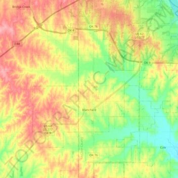
Name: Blanchard topographic map, elevation, terrain.
Location: Blanchard, McClain County, Oklahoma, 73010, United States (35.07317 -97.72368 35.24129 -97.59970)
Average elevation: 384 m
Minimum elevation: 336 m
Maximum elevation: 435 m
Thank you for supporting this site ❤️
Make a donation
Make a donation