
Feistritz im Rosental topographic map
Interactive map
Click on the map to display elevation.
About this map
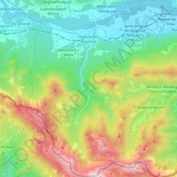
Name: Feistritz im Rosental topographic map, elevation, terrain.
Average elevation: 1,014 m
Minimum elevation: 425 m
Maximum elevation: 2,219 m
Other topographic maps
Click on a map to view its topography, its elevation and its terrain.
Wörthersee
Oostenrijk > Karinthië > Bezirk Klagenfurt-Land > Schiefling am Wörthersee
Wörthersee, Schiefling am Wörthersee, Bezirk Klagenfurt-Land, Karinthië, Oostenrijk
Average elevation: 619 m