
Maltatal topographic map
Interactive map
Click on the map to display elevation.
About this map
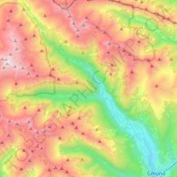
Name: Maltatal topographic map, elevation, terrain.
Average elevation: 1,914 m
Minimum elevation: 737 m
Maximum elevation: 3,327 m
Other topographic maps
Click on a map to view its topography, its elevation and its terrain.
Hauptspeicher Kölnbrein
Oostenrijk > Karinthië > Bezirk Spittal an der Drau > Malta
Hauptspeicher Kölnbrein, Malta, Bezirk Spittal an der Drau, Karinthië, 9854, Oostenrijk
Average elevation: 2,185 m