
Predjama topographic map
Interactive map
Click on the map to display elevation.
About this map
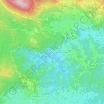
Name: Predjama topographic map, elevation, terrain.
Location: Predjama, Postojna, Slovenië (45.79418 14.10914 45.83418 14.14914)
Average elevation: 598 m
Minimum elevation: 487 m
Maximum elevation: 865 m