
Oseiro topographic map
Interactive map
Click on the map to display elevation.
About this map
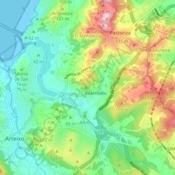
Name: Oseiro topographic map, elevation, terrain.
Location: Oseiro, Vilarrodís, Arteixo, La Coruña, Galicia, 15141, España (43.29648 -8.51818 43.34179 -8.44961)
Average elevation: 77 m
Minimum elevation: -12 m
Maximum elevation: 244 m