
Thank you for supporting this site ❤️
Make a donation
Make a donation
Charente topographic map
Click on the map to display elevation.
Thank you for supporting this site ❤️
Make a donation
Make a donation
About this map
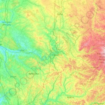
Name: Charente topographic map, elevation, terrain.
Location: Charente, Nouvelle-Aquitaine, Metropolitan France, France (45.19255 -0.46314 46.14090 0.94704)
Average elevation: 114 m
Minimum elevation: 1 m
Maximum elevation: 422 m
Thank you for supporting this site ❤️
Make a donation
Make a donation
Other topographic maps
Click on a map to view its topography, its elevation and its terrain.