
Straßburg topographic map
Interactive map
Click on the map to display elevation.
About this map
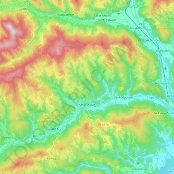
Name: Straßburg topographic map, elevation, terrain.
Average elevation: 878 m
Minimum elevation: 561 m
Maximum elevation: 1,470 m
Other topographic maps
Click on a map to view its topography, its elevation and its terrain.
Flattnitz
Oostenrijk > Karinthië > Bezirk Sankt Veit an der Glan > Glödnitz > Flattnitz
Flattnitz, Glödnitz, Bezirk Sankt Veit an der Glan, Karinthië, 9346, Oostenrijk
Average elevation: 1,517 m