
Wolhusen topographic map
Interactive map
Click on the map to display elevation.
About this map
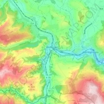
Name: Wolhusen topographic map, elevation, terrain.
Location: Wolhusen, Luzern, 6110, Schweiz (47.02880 8.01578 47.08225 8.08997)
Average elevation: 698 m
Minimum elevation: 536 m
Maximum elevation: 952 m