
Thank you for supporting this site ❤️
Make a donation
Make a donation
Livingston topographic map
Click on the map to display elevation.
Thank you for supporting this site ❤️
Make a donation
Make a donation
About this map
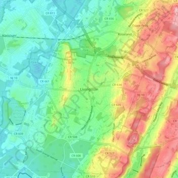
Name: Livingston topographic map, elevation, terrain.
Location: Livingston, Essex County, New Jersey, 07039, United States (40.75593 -74.35487 40.83593 -74.27487)
Average elevation: 102 m
Minimum elevation: 47 m
Maximum elevation: 198 m
Thank you for supporting this site ❤️
Make a donation
Make a donation