
Thank you for supporting this site ❤️
Make a donation
Make a donation
Arundel topographic map
Click on the map to display elevation.
Thank you for supporting this site ❤️
Make a donation
Make a donation
About this map
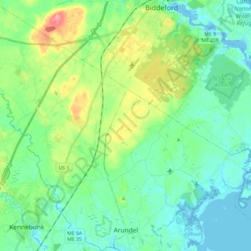
Name: Arundel topographic map, elevation, terrain.
Location: Arundel, York County, Maine, 04046, United States (43.37220 -70.60725 43.49626 -70.47695)
Average elevation: 25 m
Minimum elevation: -6 m
Maximum elevation: 94 m
Thank you for supporting this site ❤️
Make a donation
Make a donation
Other topographic maps
Click on a map to view its topography, its elevation and its terrain.
Thank you for supporting this site ❤️
Make a donation
Make a donation
Thank you for supporting this site ❤️
Make a donation
Make a donation