
Klandasan Ilir topographic map
Interactive map
Click on the map to display elevation.
About this map
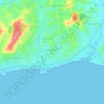
Name: Klandasan Ilir topographic map, elevation, terrain.
Location: Klandasan Ilir, Kalimantan oriental, 76121, Indonésie (-1.29157 116.82253 -1.25157 116.86253)
Average elevation: 17 m
Minimum elevation: 0 m
Maximum elevation: 89 m
Other topographic maps
Click on a map to view its topography, its elevation and its terrain.
Lombok
Indonésie > Kalimantan oriental > Paser
Lombok, Paser, Kalimantan oriental, Kalimantan, Indonésie
Average elevation: 20 m