
Thank you for supporting this site ❤️
Make a donation
Make a donation
San Angelo topographic map
Click on the map to display elevation.
Thank you for supporting this site ❤️
Make a donation
Make a donation
About this map
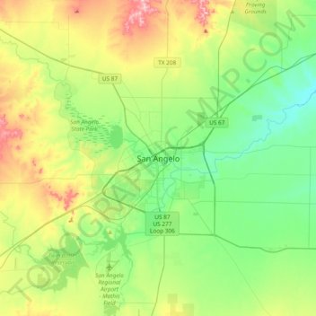
Name: San Angelo topographic map, elevation, terrain.
Location: San Angelo, Tom Green County, Texas, 76903, United States (31.30497 -100.60051 31.62497 -100.28051)
Average elevation: 588 m
Minimum elevation: 526 m
Maximum elevation: 719 m
Thank you for supporting this site ❤️
Make a donation
Make a donation