
Guija topographic map
Interactive map
Click on the map to display elevation.
About this map
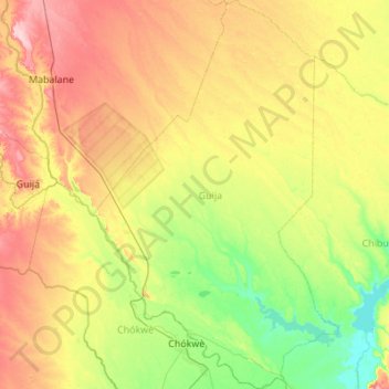
Name: Guija topographic map, elevation, terrain.
Location: Guija, Gaza Province, Mozambique (-24.64165 32.73847 -23.64332 33.43076)
Average elevation: 54 m
Minimum elevation: 6 m
Maximum elevation: 144 m
Other topographic maps
Click on a map to view its topography, its elevation and its terrain.