
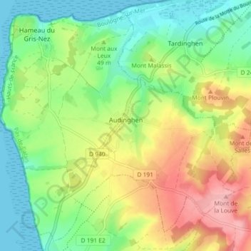
Audinghen topographic map
Interactive map
Click on the map to display elevation.
About this map
Name: Audinghen topographic map, elevation, terrain.
Average elevation: 49 m
Minimum elevation: 0 m
Maximum elevation: 123 m
Other topographic maps
Click on a map to view its topography, its elevation and its terrain.
Cap Gris-Nez
France > Hauts-de-France > Audinghen
Cap Gris-Nez, Audinghen, Boulogne-sur-Mer, Pas-de-Calais, Hauts-de-France, France métropolitaine, 62179, France
Average elevation: 14 m