
Thank you for supporting this site ❤️
Make a donation
Make a donation
広名田 topographic map
Click on the map to display elevation.
Thank you for supporting this site ❤️
Make a donation
Make a donation
About this map
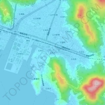
Name: 広名田 topographic map, elevation, terrain.
Location: 広名田, Kure, Hiroshima Prefecture, 737-0125, Japan (34.20664 132.60537 34.24664 132.64537)
Average elevation: 54 m
Minimum elevation: -4 m
Maximum elevation: 347 m
Thank you for supporting this site ❤️
Make a donation
Make a donation