
Thank you for supporting this site ❤️
Make a donation
Make a donation
Framlingham topographic map
Click on the map to display elevation.
Thank you for supporting this site ❤️
Make a donation
Make a donation
About this map
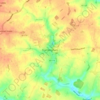
Name: Framlingham topographic map, elevation, terrain.
Location: Framlingham, East Suffolk, Suffolk, England, United Kingdom (52.19493 1.29719 52.24912 1.38138)
Average elevation: 45 m
Minimum elevation: 16 m
Maximum elevation: 63 m
Thank you for supporting this site ❤️
Make a donation
Make a donation