
Thank you for supporting this site ❤️
Make a donation
Make a donation
Nájera topographic map
Click on the map to display elevation.
Thank you for supporting this site ❤️
Make a donation
Make a donation
About this map
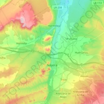
Name: Nájera topographic map, elevation, terrain.
Location: Nájera, La Rioja, 26300, Espanha (42.37796 -2.78970 42.48067 -2.65066)
Average elevation: 545 m
Minimum elevation: 433 m
Maximum elevation: 706 m
Thank you for supporting this site ❤️
Make a donation
Make a donation
Other topographic maps
Click on a map to view its topography, its elevation and its terrain.