
Wida topographic map
Interactive map
Click on the map to display elevation.
About this map
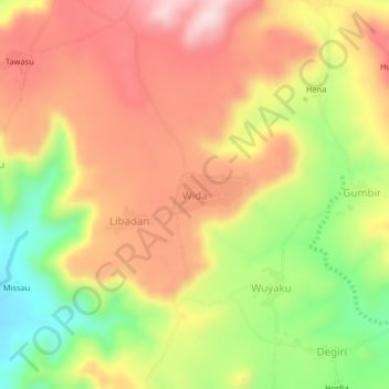
Name: Wida topographic map, elevation, terrain.
Location: Wida, Gwangang Chata, Hawul, Borno, Nigeria (10.36822 12.07374 10.40822 12.11374)
Average elevation: 623 m
Minimum elevation: 450 m
Maximum elevation: 762 m