
Thank you for supporting this site ❤️
Make a donation
Make a donation
Thale topographic map
Click on the map to display elevation.
Thank you for supporting this site ❤️
Make a donation
Make a donation
About this map
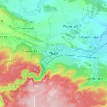
Name: Thale topographic map, elevation, terrain.
Location: Thale, Landkreis Harz, Sachsen-Anhalt, 06502, Deutschland (51.71276 10.99772 51.79276 11.07772)
Average elevation: 259 m
Minimum elevation: 130 m
Maximum elevation: 503 m
Thank you for supporting this site ❤️
Make a donation
Make a donation