
Musi River topographic map
Interactive map
Click on the map to display elevation.
About this map
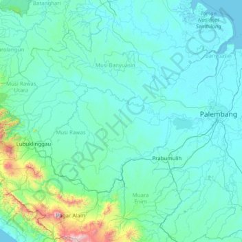
Name: Musi River topographic map, elevation, terrain.
Location: Musi River, Sumatra, Indonesia (-3.78917 102.49611 -2.33736 104.95725)
Average elevation: 146 m
Minimum elevation: -3 m
Maximum elevation: 2,981 m
Other topographic maps
Click on a map to view its topography, its elevation and its terrain.