
Garda topographic map
Interactive map
Click on the map to display elevation.
About this map
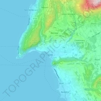
Name: Garda topographic map, elevation, terrain.
Location: Garda, Verona, Vénétie, 37016, Italie (45.56713 10.63096 45.59061 10.73965)
Average elevation: 173 m
Minimum elevation: 61 m
Maximum elevation: 877 m
Other topographic maps
Click on a map to view its topography, its elevation and its terrain.