
Turtle River topographic map
Interactive map
Click on the map to display elevation.
About this map
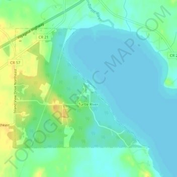
Name: Turtle River topographic map, elevation, terrain.
Location: Turtle River, Beltrami County, Minnesota, United States (47.58074 -94.76833 47.59905 -94.73779)
Average elevation: 405 m
Minimum elevation: 397 m
Maximum elevation: 422 m
Turtle River is a town in Beltrami County, Minnesota, United States. The population was 77 at the 2010 census. The elevation is 1,332 ft (406m). It is approximately 17 miles northeast of Bemidji, where most community services are available. Turtle River consists of two stores, a restaurant, a gas station, and a church.