
Vensac topographic map
Interactive map
Click on the map to display elevation.
About this map
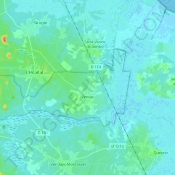
Name: Vensac topographic map, elevation, terrain.
Average elevation: 4 m
Minimum elevation: -2 m
Maximum elevation: 34 m
Other topographic maps
Click on a map to view its topography, its elevation and its terrain.
Le Four
France > Nouvelle-Aquitaine > Gironde > Lège-Cap-Ferret
Le Four, Lège-Cap-Ferret, Arcachon, Gironde, Nouvelle-Aquitaine, Metropolitan France, France
Average elevation: 3 m
Braud-et-Saint-Louis
France > Nouvelle-Aquitaine > Gironde > Braud-et-Saint-Louis
Braud-et-Saint-Louis, Blaye, Gironde, Nouvelle-Aquitaine, Metropolitan France, 33820, France
Average elevation: 9 m
Bordeaux
France > Nouvelle-Aquitaine > Gironde
Bordeaux, Gironde, Nouvelle-Aquitaine, Metropolitan France, France
Average elevation: 18 m