
Huaraz topographic map
Interactive map
Click on the map to display elevation.
About this map
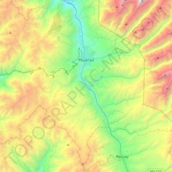
Name: Huaraz topographic map, elevation, terrain.
Location: Huaraz, Province of Huaraz, Ancash, Peru (-9.73787 -77.64720 -9.42711 -77.30057)
Average elevation: 4,075 m
Minimum elevation: 2,849 m
Maximum elevation: 6,097 m
Other topographic maps
Click on a map to view its topography, its elevation and its terrain.