
Iramba topographic map
Interactive map
Click on the map to display elevation.
About this map
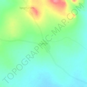
Name: Iramba topographic map, elevation, terrain.
Location: Iramba, Ushetu, Shinyanga Region, Lake Zone, Tanzania (-3.85542 32.26573 -3.81542 32.30573)
Average elevation: 1,210 m
Minimum elevation: 1,182 m
Maximum elevation: 1,274 m
Other topographic maps
Click on a map to view its topography, its elevation and its terrain.
Ibadakuli
Ibadakuli, Shinyanga Urban, Shinyanga Region, Lake Zone, Tanzania
Average elevation: 1,156 m