
Hajigabul District topographic map
Interactive map
Click on the map to display elevation.
About this map
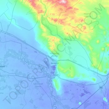
Name: Hajigabul District topographic map, elevation, terrain.
Location: Hajigabul District, Shirvan-Salyan, 2400, Azerbaijan (39.80937 48.45486 40.35499 49.36349)
Average elevation: 94 m
Minimum elevation: -29 m
Maximum elevation: 1,037 m
Other topographic maps
Click on a map to view its topography, its elevation and its terrain.