
Absheron District topographic map
Interactive map
Click on the map to display elevation.
About this map
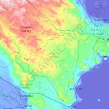
Name: Absheron District topographic map, elevation, terrain.
Location: Absheron District, Absheron-Khizi, Azerbaijan (39.99459 48.86422 40.68358 49.93474)
Average elevation: 252 m
Minimum elevation: -30 m
Maximum elevation: 1,333 m
Other topographic maps
Click on a map to view its topography, its elevation and its terrain.