
Bahawalpur City Tehsil topographic map
Interactive map
Click on the map to display elevation.
About this map
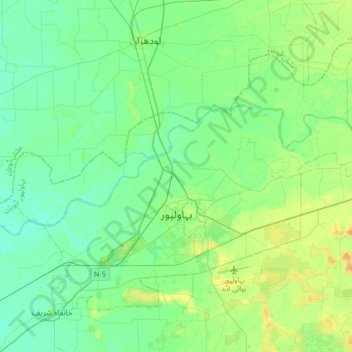
Name: Bahawalpur City Tehsil topographic map, elevation, terrain.
Average elevation: 118 m
Minimum elevation: 110 m
Maximum elevation: 135 m
Other topographic maps
Click on a map to view its topography, its elevation and its terrain.
Fort Derawar
Pakistan > Punjab > Bahawalpur District > Derawar
Fort Derawar, Derawar, Yazman Tehsil, Bahawalpur District, Punjab, Pakistan
Average elevation: 104 m