

Israel topographic maps
Click on a map to view its topography, its elevation and its terrain.
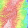
Jerusalem
Jerusalem is situated on the southern spur of a plateau in the Judaean Mountains, which include the Mount of Olives (East) and Mount Scopus (North East). The elevation of the Old City is approximately 760 m (2,490 ft).[310] The whole of Jerusalem is surrounded by valleys and dry riverbeds (wadis). The Kidron,…
Average elevation: 520 m


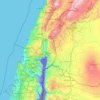
Golan Heights
Israel > North District > Golan Regional Council
The plateau that Israel controls is part of a larger area of volcanic basalt fields stretching north and east that were created in the series of volcanic eruptions that began recently in geological terms, almost 4 million years ago. The rock forming the mountainous area in the northern Golan Heights,…
Average elevation: 533 m