

Tamanrasset topographic maps
Click on a map to view its topography, its elevation and its terrain.

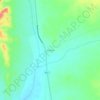
Tamanghasset
Algeria > Tamanrasset > de Tamanrasset District
Tamanrasset (/ˌtæmənˈræsət, -sɛt/; Tamazight: ⵜⵎⵏⵗⵙⵜ, romanized: Tmnghst, Arabic: تامنراست, romanized: Tāmanrāssit), also known as Tamanghasset or Tamenghest, is an oasis city and capital of Tamanrasset Province in southern Algeria, in the Ahaggar Mountains. It is the chief city of…
Average elevation: 907 m

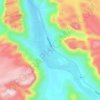
Abalessa
Algeria > Tamanrasset > Abalessa District
The municipality reaches an average elevation of approximately 909 metres (2,982 ft) above sea level. The main town lies at an elevation of 893 metres (2,930 ft), at the confluence of the two intermittent wadis Oued Rellachene and Oued Iheri. A rocky mountain range, part of the Ahaggar Mountains rises to the…
Average elevation: 776 m

Idles
Algeria > Tamanrasset > Tazrouk District
Idlès is located at an elevation of 1,399 metres (4,590 ft) in the Hoggar mountains of southern Algeria. The town lies on the eastern bank of the Oued Tarouda. The surrounding area belongs to the West Saharan montane xeric woodlands ecoregion.
Average elevation: 922 m

In Amguel
Algeria > Tamanrasset > de Tamanrasset District
In Amguel lies at an elevation of 980 metres (3,220 ft) on the southern bank of a wadi that cuts through a plateau lying to the northwest of the Hoggar Mountains. The numerous wadis in the area support some vegetation, but beyond them the land is barren and rocky.
Average elevation: 914 m

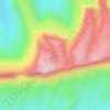
Hoggar Mountains
Algeria > Tamanrasset > de Tamanrasset District > Tamanghasset
This mountainous region is located about 1,500 km (930 mi) south of the capital, Algiers. The area is largely rocky desert with an average elevation of more than 900 m (3,000 ft) above sea level. The highest peak, Mount Tahat, is at 2,908 m (9,541 ft). The mountains are primarily composed of metamorphic rock…
Average elevation: 2,451 m

Tazrouk
Algeria > Tamanrasset > Tazrouk District
Tazrouk is located in the Hoggar mountains at an altitude of 1,827 metres (5,994 ft). Most of the town is located on the east bank of a wadi that runs past the town from the northwest to the southeast.
Average elevation: 923 m

Tahat
Algeria > Tamanrasset > de Tamanrasset District > Tamanghasset
Mount Tahat (Arabic: جبل تاهات) is the highest mountain in Algeria. It sits at an elevation of 2,908 metres (9,541 ft). Other sources indicate an elevation of 3,003 metres (9,852 ft). Tahat is also the highest peak in the Hoggar Mountains. Its nearest city is Tamanrasset which is located 56 kilometres…
Average elevation: 2,466 m
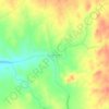

Sahara
Algeria > Tamanrasset > Tazrouk District > Tazrouk
The high position of the Sun, the extremely low relative humidity, and the lack of vegetation and rainfall make the Great Desert the hottest large region in the world, and the hottest place on Earth during summer in some spots. The average high temperature exceeds 38 to 40 °C (100.4 to 104.0 °F) during the…
Average elevation: 650 m