
Vythiri topographic map
Interactive map
Click on the map to display elevation.
About this map
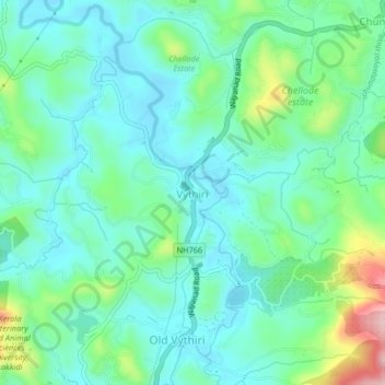
Name: Vythiri topographic map, elevation, terrain.
Location: Vythiri, Wayanad, Kerala, 673576, India (11.53617 76.01896 11.57617 76.05896)
Average elevation: 781 m
Minimum elevation: 729 m
Maximum elevation: 941 m
Other topographic maps
Click on a map to view its topography, its elevation and its terrain.