
Rio Churun topographic map
Interactive map
Click on the map to display elevation.
About this map
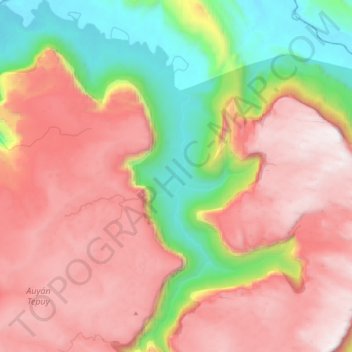
Name: Rio Churun topographic map, elevation, terrain.
Average elevation: 1,323 m
Minimum elevation: 434 m
Maximum elevation: 2,096 m
Other topographic maps
Click on a map to view its topography, its elevation and its terrain.
Canaima
Venezuela > Estado Bolívar > Parroquia Sección Capital Gran Sabana > Canaima
Canaima, Parroquia Sección Capital Gran Sabana, Distrito Piar, Estado Bolívar, Venezuela
Average elevation: 422 m