
Lakehurst topographic map
Interactive map
Click on the map to display elevation.
About this map
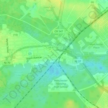
Name: Lakehurst topographic map, elevation, terrain.
Average elevation: 21 m
Minimum elevation: 11 m
Maximum elevation: 31 m
The borough's lake, Lake Horicon, existed prior to 1942, as clearly shown in aerial photographs from 1940 and 1931 and topographical maps from 1912. The cedar water lake remains stream-fed.