Geolocate

Temghar dam topographic map

Interactive map

Click on the map to display elevation.

About this map

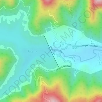
Name: Temghar dam topographic map, elevation, terrain.

Location: Temghar dam, Pune, Maharashtra, 411001, India (18.44873 73.53856 18.45733 73.54276)

Average elevation: 745 m

Minimum elevation: 639 m

Maximum elevation: 995 m

Other topographic maps

Click on a map to view its topography, its elevation and its terrain.

Anandnagar

India > Maharashtra > Pune

Average elevation: 601 m

Sinhagad Vikas Udyan

India > Maharashtra > Pune

Average elevation: 580 m

Phulenagar

India > Maharashtra > Pune > Khadki

Average elevation: 557 m

Wagholi

India > Maharashtra > Pune

Average elevation: 578 m

Koregaon Park

India > Maharashtra > Pune

Average elevation: 555 m

Katraj

India > Maharashtra > Pune

Average elevation: 662 m

Vetal Tekdi

India > Maharashtra > Pune

Average elevation: 622 m

Kondhwa Budruk

India > Maharashtra > Pune

Average elevation: 656 m