
Jalalabad topographic map
Interactive map
Click on the map to display elevation.
About this map
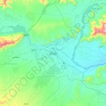
Name: Jalalabad topographic map, elevation, terrain.
Location: Jalalabad, Nangarhar, 004847, Afghanistan (34.27020 70.30013 34.59020 70.62013)
Average elevation: 706 m
Minimum elevation: 507 m
Maximum elevation: 1,737 m