
Béziers topographic map
Interactive map
Click on the map to display elevation.
About this map
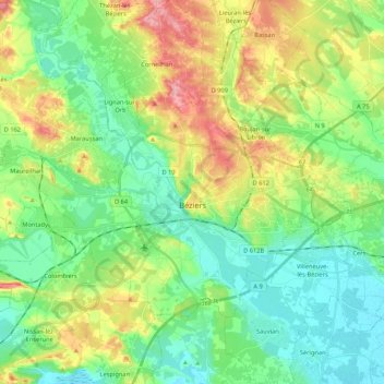
Name: Béziers topographic map, elevation, terrain.
Location: Béziers, Hérault, Occitania, Metropolitan France, 34500, France (43.29711 3.12750 43.39849 3.34104)
Average elevation: 44 m
Minimum elevation: 0 m
Maximum elevation: 132 m