
Salt Lake County topographic map
Interactive map
Click on the map to display elevation.
About this map
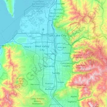
Name: Salt Lake County topographic map, elevation, terrain.
Location: Salt Lake County, Utah, Estados Unidos (40.41486 -112.26018 40.92188 -111.55323)
Average elevation: 1,811 m
Minimum elevation: 1,278 m
Maximum elevation: 3,493 m