
El Karia topographic map
Interactive map
Click on the map to display elevation.
About this map
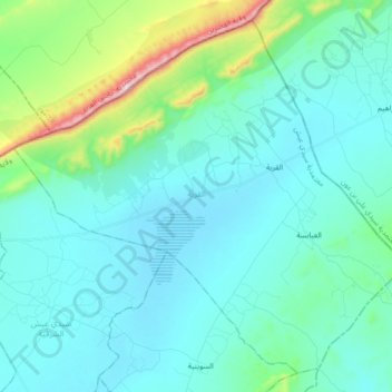
Name: El Karia topographic map, elevation, terrain.
Location: El Karia, Sidi Aïch, Gafsa, Tunisie (34.68009 8.81400 34.81023 8.98957)
Average elevation: 531 m
Minimum elevation: 441 m
Maximum elevation: 1,015 m
Other topographic maps
Click on a map to view its topography, its elevation and its terrain.