
Faridabad topographic map
Interactive map
Click on the map to display elevation.
About this map
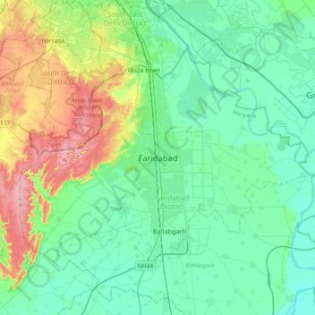
Name: Faridabad topographic map, elevation, terrain.
Location: Faridabad, Haryana, 121001, India (28.24315 77.15056 28.56315 77.47056)
Average elevation: 217 m
Minimum elevation: 185 m
Maximum elevation: 314 m
Other topographic maps
Click on a map to view its topography, its elevation and its terrain.