
Hirakud topographic map
Interactive map
Click on the map to display elevation.
About this map
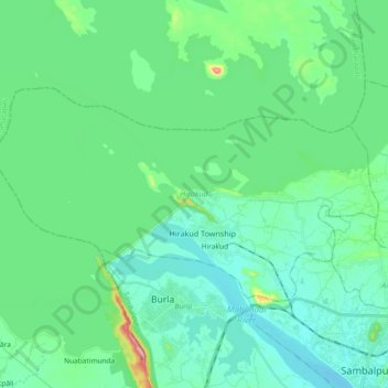
Name: Hirakud topographic map, elevation, terrain.
Location: Hirakud, Sambalpur, Odisha, 768016, India (21.50111 83.79691 21.59595 83.98172)
Average elevation: 181 m
Minimum elevation: 138 m
Maximum elevation: 378 m
Other topographic maps
Click on a map to view its topography, its elevation and its terrain.
Hirakud Dam
Hirakud Dam, Hirakud Township, Hirakud, Sambalpur, Odisha, India
Average elevation: 178 m