
Waghai topographic map
Interactive map
Click on the map to display elevation.
About this map
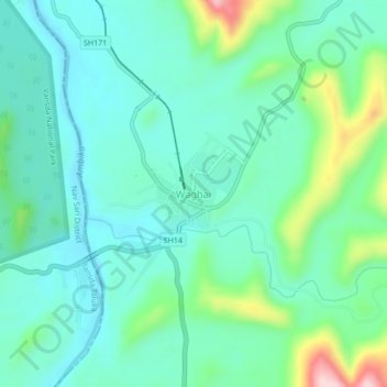
Name: Waghai topographic map, elevation, terrain.
Location: Waghai, Vaghai Taluka, The Dangs, Gujarat, 394730, India (20.75104 73.48165 20.79104 73.52165)
Average elevation: 161 m
Minimum elevation: 100 m
Maximum elevation: 364 m
Other topographic maps
Click on a map to view its topography, its elevation and its terrain.
Vansda National Park
Vansda National Park, Bansda Taluka, Nav Sari District, Gujarat, India
Average elevation: 160 m