
Punganuru topographic map
Interactive map
Click on the map to display elevation.
About this map
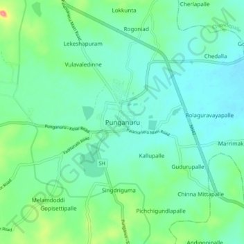
Name: Punganuru topographic map, elevation, terrain.
Location: Punganuru, Punganur, Andhra Pradesh, 517247, India (13.32396 78.53193 13.40396 78.61193)
Average elevation: 737 m
Minimum elevation: 714 m
Maximum elevation: 816 m
Punganur is located at 13°22′00″N 78°35′00″E / 13.3667°N 78.5833°E / 13.3667; 78.5833. It has an average elevation of 764 meters (2509 feet).