
Thank you for supporting this site ❤️
Make a donation
Make a donation
Ambernath topographic map
Click on the map to display elevation.
Thank you for supporting this site ❤️
Make a donation
Make a donation
About this map
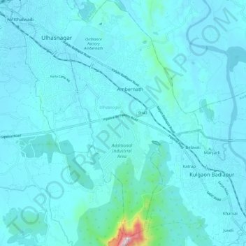
Name: Ambernath topographic map, elevation, terrain.
Location: Ambernath, Ulhasnagar, Thane, Maharashtra, India (19.13432 73.16066 19.23956 73.23347)
Average elevation: 55 m
Minimum elevation: 1 m
Maximum elevation: 767 m
Thank you for supporting this site ❤️
Make a donation
Make a donation