
Nagothane topographic map
Interactive map
Click on the map to display elevation.
About this map
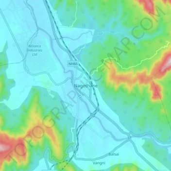
Name: Nagothane topographic map, elevation, terrain.
Location: Nagothane, Roha, Raigad District, Maharashtra, 402106, India (18.50407 73.09629 18.58407 73.17629)
Average elevation: 79 m
Minimum elevation: 0 m
Maximum elevation: 424 m
Other topographic maps
Click on a map to view its topography, its elevation and its terrain.
Kudali
India > Maharashtra > Roha
Kudali, Roha, Raigad, Maharashtra, 402308, India
Average elevation: 124 m