
Ashtapur topographic map
Interactive map
Click on the map to display elevation.
About this map
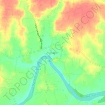
Name: Ashtapur topographic map, elevation, terrain.
Location: Ashtapur, Haveli, Pune District, Maharashtra, India (18.52646 74.11153 18.56646 74.15153)
Average elevation: 541 m
Minimum elevation: 510 m
Maximum elevation: 570 m