
Okaloosa County topographic map
Interactive map
Click on the map to display elevation.
About this map
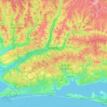
Name: Okaloosa County topographic map, elevation, terrain.
Location: Okaloosa County, Florida, United States (30.32535 -86.80055 30.99698 -86.38852)
Average elevation: 37 m
Minimum elevation: -3 m
Maximum elevation: 106 m
Other topographic maps
Click on a map to view its topography, its elevation and its terrain.
Holt
United States > Florida > Okaloosa County
Holt, Okaloosa County, Florida, 32546, United States
Average elevation: 53 m