
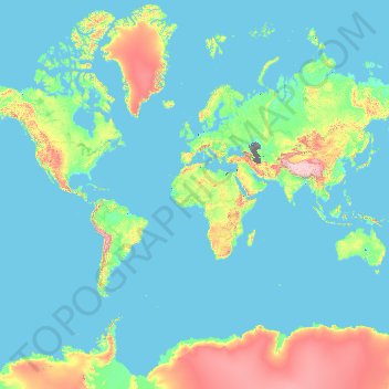
France topographic map
Interactive map
Click on the map to display elevation.
About this map
Name: France topographic map, elevation, terrain.
Location: France (-50.21872 -178.38737 51.30557 172.30572)
Average elevation: 430 m
Minimum elevation: -30 m
Maximum elevation: 6,542 m
Metropolitan France has a wide variety of topographical sets and natural landscapes. Large parts of the current territory of France were raised during several tectonic episodes like the Hercynian uplift in the Paleozoic Era, during which the Armorican Massif, the Massif Central, the Morvan, the Vosges and Ardennes ranges and the island of Corsica were formed. These massifs delineate several sedimentary basins such as the Aquitaine basin in the southwest and the Paris basin in the north, the latter including several areas of particularly fertile ground such as the silt beds of Beauce and Brie. Various routes of natural passage, such as the Rhône Valley, allow easy communication. The Alpine, Pyrenean and Jura mountains are much younger and have less eroded forms. At 4,810.45 metres (15,782 ft) above sea level, Mont Blanc, located in the Alps on the French and Italian border, is the highest point in Western Europe. Although 60% of municipalities are classified as having seismic risks, these risks remain moderate.
Other topographic maps
Click on a map to view its topography, its elevation and its terrain.
India
India
Average elevation: 1,017 m
Montreal
Canada > Quebec > Urban agglomeration of Montreal > Montreal
Montreal, Urban agglomeration of Montreal, Montreal (06), Quebec, H3B 1M7, Canada
Average elevation: 30 m
Hyderabad
India > Telangana > Bahadurpura mandal
Hyderabad, Bahadurpura mandal, Hyderabad District, Telangana, India
Average elevation: 549 m
Tacoma
United States > Washington > Pierce County
Tacoma, Pierce County, Washington, United States
Average elevation: 67 m
Sri Lanka
Sri Lanka
Average elevation: 50 m
Kandy
Kandy, Kandy District, Central Province, 20000, Sri Lanka
Average elevation: 621 m
Pune
India > Maharashtra > Pune City > Pune
Pune, Pune City, Pune District, Maharashtra, 411001, India
Average elevation: 641 m
Bengaluru
India > Karnataka > Bangalore North
Bengaluru, Bangalore North, Bengaluru Urban District, Karnataka, India
Average elevation: 881 m
saraikhet
India > Uttarakhand > Dhoomakot
saraikhet, Dhoomakot, Pauri Garhwal District, Uttarakhand, India
Average elevation: 1,861 m
Surat
India > Gujarat > Katargam Taluka > Surat
Surat, Katargam Taluka, Surat, Gujarat, 395001, India
Average elevation: 11 m
Bhatwari
Bhatwari, Uttarkashi District, Uttarakhand, India
Average elevation: 4,570 m
Dahej
India > Gujarat > Vagra Taluka
Dahej, Vagra Taluka, Bharuch District, Gujarat, 393125, India
Average elevation: 6 m
Chennai
India > Tamil Nadu > Chennai
Chennai, Chennai District, Tamil Nadu, India
Average elevation: 8 m
Dudori
India > Uttarakhand > Syalde > Kaljipa
Dudori, Kaljipa, Syalde, Almora District, Uttarakhand, 263665, India
Average elevation: 1,564 m
Vairavanpatti
India > Tamil Nadu > Thiruppathur
Vairavanpatti, Thiruppathur, Sivagangai District, Tamil Nadu, 630207, India
Average elevation: 103 m
Vadodara
India > Gujarat > Vadodara Taluka
Vadodara, Vadodara Taluka, Vadodara District, Gujarat, 390001, India
Average elevation: 36 m
Naula
India > Uttarakhand > Bhanoli
Naula, Bhanoli, Almora District, Uttarakhand, India
Average elevation: 1,562 m
Rajmachi Fort
India > Maharashtra > Mawal > Udhewadi
Rajmachi Fort, Udhewadi, Mawal, Pune District, Maharashtra, India
Average elevation: 501 m
Pura
Indonesia > East Nusa Tenggara > Alor
Pura, Alor, East Nusa Tenggara, Lesser Sunda Islands, Indonesia
Average elevation: 275 m
Malhargad Fort
India > Maharashtra > Purandhar
Malhargad Fort, Malhargad Walking Path, Purandhar, Pune District, Maharashtra, India
Average elevation: 822 m
Visapur Fort
India > Maharashtra > Mawal > Patan
Visapur Fort, Bhatrishi peak, Patan, Mawal, Pune District, Maharashtra, 410401, India
Average elevation: 818 m
Gladstone Regional
Gladstone Regional, Queensland, Australia
Average elevation: 116 m
Mount Maria
Mount Maria, Toowoomba Regional, Queensland, Australia
Average elevation: 382 m
Dadholi
India > Uttarakhand > Dwarahat
Dadholi, Dwarahat, Almora District, Uttarakhand, 263654, India
Average elevation: 1,449 m
Sinhagad Vikas Udyan
India > Maharashtra > Pune
Sinhagad Vikas Udyan, Vadgaon Budruk, Pune, Pune District, Maharashtra, 411051, India
Average elevation: 580 m
City of Medan
City of Medan, North Sumatra, Sumatra, Indonesia
Average elevation: 18 m
Shakarpur
India > Delhi > Gandhi Nagar Tehsil
Shakarpur, Gandhi Nagar Tehsil, East Delhi District, Delhi, India
Average elevation: 206 m
Clappana
India > Kerala > Karunagappally
Clappana, Karunagappally, Kollam District, Kerala, 690525, India
Average elevation: 5 m
Bourne
United States > Massachusetts > Barnstable County
Bourne, Barnstable County, Massachusetts, United States
Average elevation: 20 m
Dexter Canyon
United States > California > Santa Clara County
Dexter Canyon, Santa Clara County, California, United States
Average elevation: 529 m
Broomehill Village
Broomehill Village, Shire Of Broomehill-Tambellup, Western Australia, Australia
Average elevation: 325 m
Siliguri
India > West Bengal > Siliguri Subdivsion
Siliguri, Siliguri Subdivsion, Darjeeling District, West Bengal, India
Average elevation: 121 m
Haywood County
United States > North Carolina
Haywood County, North Carolina, United States
Average elevation: 1,044 m
Nepal
Nepal
Average elevation: 2,604 m
Kariyana
India > Rajasthan > Sagwara Tehsil
Kariyana, Sagwara Tehsil, Dungarpur District, Rajasthan, 314032, India
Average elevation: 167 m
Panvel
India > Maharashtra > Panvel > Panvel
Panvel, Raigad, Maharashtra, 410206, India
Average elevation: 75 m
Thiruvananthapuram
India > Kerala > Thiruvananthapuram
Thiruvananthapuram, Thiruvananthapuram District, Kerala, 695001, India
Average elevation: 33 m