Geolocate

Old Delhi topographic map

Interactive map

Click on the map to display elevation.

About this map

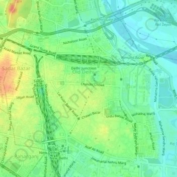
Name: Old Delhi topographic map, elevation, terrain.

Location: Old Delhi, Delhi, Central Delhi, Delhi, India (28.64077 77.20433 28.67027 77.24645)

Average elevation: 218 m

Minimum elevation: 201 m

Maximum elevation: 243 m

Other topographic maps

Click on a map to view its topography, its elevation and its terrain.

Yamuna River

India > Delhi > Delhi

Yamuna River, Doctor KB Hedgewar Marg, Kashmiri Gate, Majnu Ka Tila, Delhi, Central Delhi, Delhi, 110054, India

Average elevation: 212 m

Yamuna Biodiversity Park

India > Delhi > Delhi

Yamuna Biodiversity Park, Doctor KB Hedgewar Marg, Delhi, Central Delhi, Delhi, 110009, India

Average elevation: 209 m

Karkardooma Institutional Area

India > Delhi > Delhi

Karkardooma Institutional Area, Vivek Vihar Tehsil, Shahdara, Delhi, India

Average elevation: 207 m

Mori Gate

India > Delhi > Delhi

Mori Gate, Delhi, Kotwali Tehsil, Central Delhi, Delhi, 110006, India

Average elevation: 220 m