
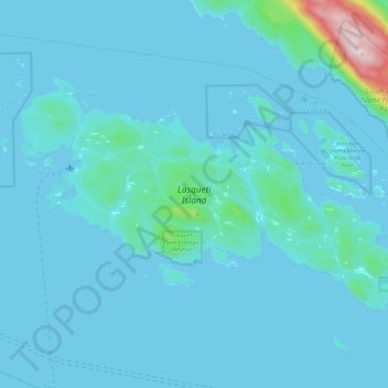
Lasqueti Island topographic map
Interactive map
Click on the map to display elevation.
About this map
Name: Lasqueti Island topographic map, elevation, terrain.
Average elevation: 52 m
Minimum elevation: -1 m
Maximum elevation: 853 m
Other topographic maps
Click on a map to view its topography, its elevation and its terrain.
Deep Bay
Canada > British Columbia > qathet Regional District > Area E (Lasqueti Island)
Deep Bay, Area E (Lasqueti Island), qathet Regional District, British Columbia, Canada
Average elevation: 13 m
Lasqueti
Canada > British Columbia > qathet Regional District > Area E (Lasqueti Island) > Lasqueti
Lasqueti, Area E (Lasqueti Island), qathet Regional District, British Columbia, V0R 2J0, Canada
Average elevation: 48 m