
Fatih topographic map
Interactive map
Click on the map to display elevation.
About this map
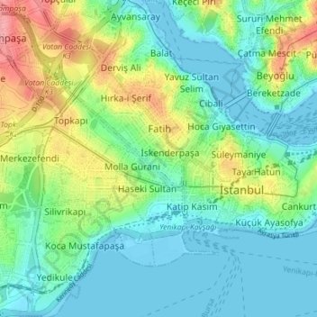
Name: Fatih topographic map, elevation, terrain.
Location: Fatih, Istanbul, Marmara Region, Turkey (40.98763 28.91902 41.04086 28.98811)
Average elevation: 29 m
Minimum elevation: -2 m
Maximum elevation: 101 m
Other topographic maps
Click on a map to view its topography, its elevation and its terrain.